across the floodplain - a common tread
short note
Hanoi, Vietnam, 2010
Hanoi is the 1000 year old capital of Vietnam and was founded in a bend of the Red River. It has developed hand-in-hand with an extensive dyke system that is challenged due to swift urbanisation and the predictions of climate change. The aim of the thesis is to link the logics of water management, infrastructure, urbanisation and landscape, in order to wrap them up in a strategic design that is founded on a strong analysis of the current water and urbanisation problematic of Yen So and therefore Hanoi. The thesis starts with a cross scale analysis, zooming in and out with relation to the Yen So area and its dykes and concludes with a design.
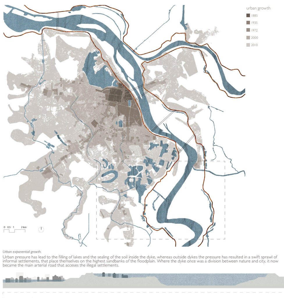
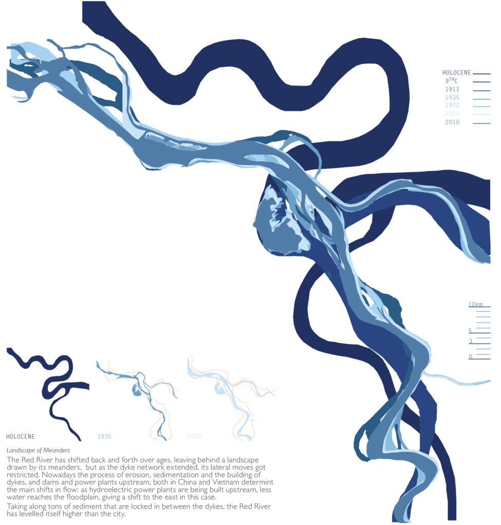
The floodplain of the Red River, just south of the urban core of Hanoi in Yen So, is the place where the river is at its widest between the dykes and were the landscape of meanders is still an ongoing process. It is also the place where the floodplain gathers many villages that still have a very rich traditional culture of crafts and agriculture. As Yen So is the lowest topographical point of Hanoi, this is the area where the water issues come together and where the Yen So pumping station is grafted onto the dyke. Located on the periphery of Hanoi, the floodplain of Yen So is not yet fully urbanized, but as the city continues to grow, settlements sprawl in the northern floodplain.
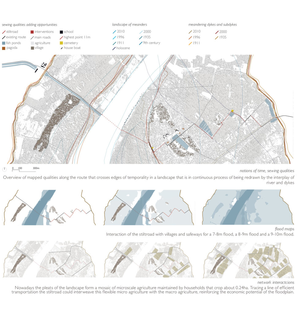
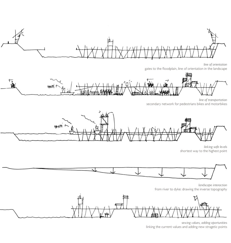
The design proposal places the floodplain in the mental map. The gesture is a route which makes the floodplain area, known for its crafts and agriculture, accessible to citizens of Hanoi and makes the city accessible to villagers bringing their harvest. It interweaves existing roads that follow the logic of the shortest distance to the highest point: the dyke. Stitching qualities and adding a layer of small-scale intervention, the route links the east and west dyke from the Yen So pumping station to the van Giang crossing, passing the villages of Yen My—a floating village-, Chu Xa and Xuan Hung Yen. The route seeks to combine points of orientation with a secondary network for light traffic and creates an interaction with the landscape, linking the highest points of safety in times of flood and stitching the current values of the floodplain. This reinforces the local agriculture and therefore generates possibilities for income, recreation and public meeting places, all with the intention of increasing the land value, so the population might then reconsider before claiming land for building illigaly inside the floodplain.
The route is constructed as an elevated temporary structure: a ‘stiltroad’ with a minimal footprint on the ground, made of knotted bamboo, that might resist a flood or two. The idea is that there is always a possibility that it would be demolished; the emphasis is upon the ephemeral, the impermanent. If the stiltroad is a story of success, villagers and citizens will cooperate and repair or reconstruct it, as bamboo is widely available in the immediate area, making the stiltroad both affordable and low maintenance.
details
Hanoi 2010 – Master Thesis, KULeuven, Belgium.
Published in Water Urbanisms East, Park Books, Zurich