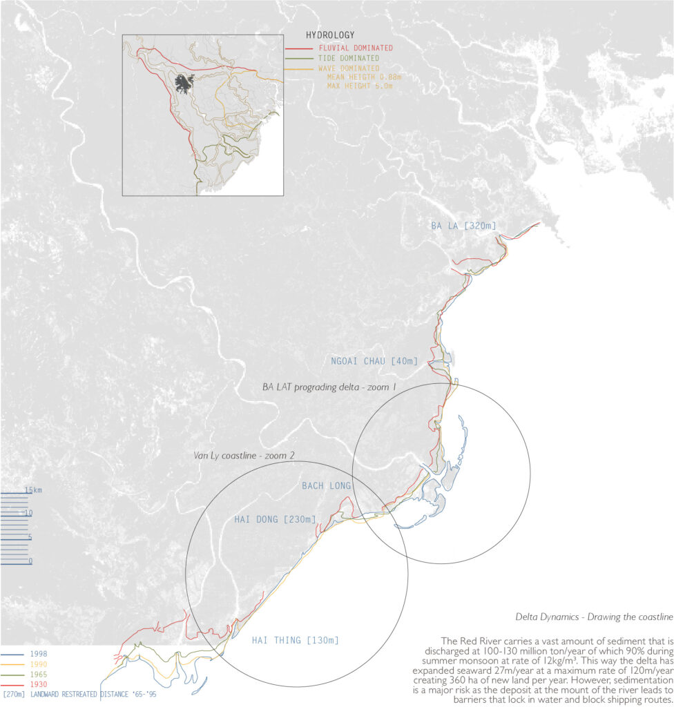
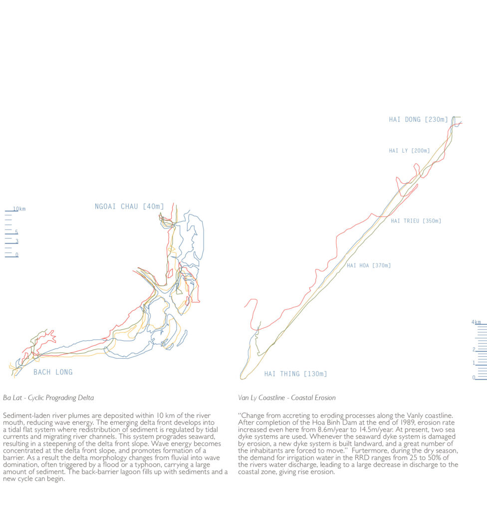
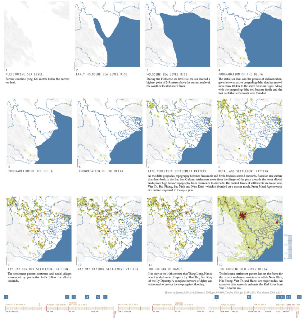
The cartographic project focusses on the typical Vietnamese landscape of water and mountains, by mapping the Mekong Delta and the Red River Delta throughout time. The first working with an adaptive design strategy to overcome the sealevel rise as a consequence of climate change, the latter strongly choosing for a fortify to protect attitude, that builds dykes, dams, sewage systems and power plants, the so called hard engineering. The research seeks to find design strategies in a specific context, by a full understanding of the territory and its current climatic challenges.